 Metadata Catalogue
Community Forest Boundary of Ludhi Khola Watershed, Gorkha, Nepal
Digital polygon dataset of Community Forest Boundary of Ludhi Khola Watershed, Gorkha, Nepal. This dataset is created using GeoEye 0.5 meter spatial resolution satellite image of November 2009 and field verified in 2010. The data was prepared for the Reducing Emission from Deforestation and Forest Degradation (REDD) Pilot Project. This is a joint project of ICIMOD with Asian Network for Sustainable Agriculture and Bioresources (ANSAB) and Federation of Community for Forest Users of Nepal (FECOFUN) funded by NORAD.
Simple
- Date ( Publication )
- 2010-07-31T00:00:00
- Edition
- First
- Identifier
- REDD, np
- Presentation form
- Digital map
- Other citation details
- ICIMOD. (2010). Community Forest Boundary of Ludhi Khola Watershed, Gorkha, Nepal [Data set]. ICIMOD. https://doi.org/10.26066/RDS.8027
- Purpose
- Locational base data for general purpose. The data was prepared for the Reducing Emission from Deforestation and Forest Degradation (REDD) Pilot Project.
- Status
- Completed
Point of contact
ICIMOD
-
Sameer Bajracharya
(
Research Associate GIS
)
977-1-5003299
Khumaltar
,
Lalitpur
,
Kathmandu
,
3226
,
Nepal
977-1-5275222
977-1-5003299
- Maintenance and update frequency
- As needed
- Keywords ( Theme )
-
- REDD
- Community Forest
- Keywords ( Place )
-
- Ludhi Khola Watershed
- Gorkha
- Nepal
- Use limitation
- Creative Commons Attribution 4.0 International (CC BY 4.0)
- Access constraints
- License
- Use constraints
- License
- Spatial representation type
- Vector
- Denominator
- 25000
- Metadata language
- eng
- Character set
- UTF8
- Topic category
-
- Boundaries
N
S
E
W
))
- Supplemental Information
- Data Source: GeoEye 0.5 meter high resolution image, November 2009, Field data 2010, Base Map: Topographic map, Department of Survey 1995.
- Reference system identifier
- WGS 1984
- Hierarchy level
- Dataset
- Statement
- The accuracy of the Digital Data prepared depends on the base source Data and Maps. No assessment or ground truthing has been carried out on this data.
- File identifier
- 25b2d5ff-4187-41e1-b0fa-afe2e9f12263 XML
- Metadata language
- eng
- Character set
- UTF8
- Date stamp
- 2026-01-30T16:25:09
- Metadata standard name
- ISO 19115:2003/19139
- Metadata standard version
- 1.0
Distributor
ICIMOD
-
Mr. Govinda Joshi
(
Sr. Cartographer/GIS Analyst
)
977-1-5003299
Khumaltar
,
Lalitpur
,
Kathmandu
,
3226
,
Nepal
977-1-5275222
977-1-5003299
Overviews
thumbnail
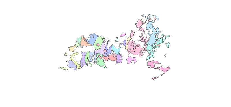
large_thumbnail
Spatial extent
N
S
E
W
Provided by

Associated resources
Not available