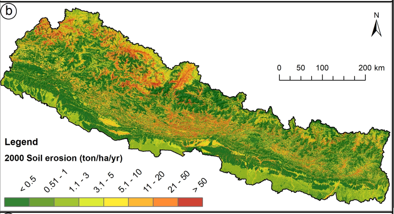
Land cover change is a critical driver for enhancing the soil erosion risk in Nepal. Losing of the topsoil has a direct and indirect effect on human life and livelihoods. The present study provides an assessment of the decadal land use and land cover (LULC) change and consequent changes in the distribution of soil erosion risk for the year of 1990, 2000 and 2010 for the entire country of Nepal. The study attempted to understand how different land cover types change over the three decades and how it has changed the distribution of soil erosion risks in Nepal that would help in development of soil conservation priority. The land cover maps were produced using Geographic object-based image analysis (GEOBIA) using Landsat images. Soil erosion patterns were assessed using the revised universal soil loss equation (RUSLE) with the land cover as input. The study shows that the forest cover is the most dominant land cover in Nepal that comprises about 62 hundred thousand ha. The estimated annual erosion was 129.30 million tons in 1990 and 110.53 million tons in 2010. The assessment of soil erosion dynamics presented at the national, provincial and district level. District wise analysis revealed that Gulmi, Parbat, Syangja and Tanahu district required priority for soil conservation