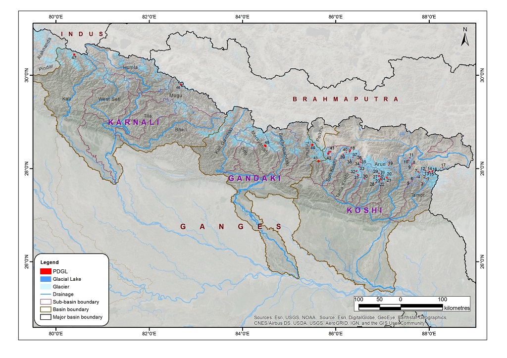
The potentially dangerous glacial lakes were identified on the basis of the glacial lake inventory dataset using Landsat imagery from 2015. The following criteria were used for classifying the lakes: i) lake characteristics, ii) dam characteristics, iii) source/associate glacier characteristics, and iv) physical conditions of surroundings. Various parameters required for classifying such lakes were generated by using 5 m ALOS DEM for Nepal and 12.5 m ALOS DEM for China and India. Data include detailed analyses of land features and conditions using high-resolution images with 3D visualization on Google Earth. The dataset provides the size, type, and altitudinal distribution of such lakes, including the hazard rank of each lake. This dataset was prepared to support the Green Climate Fund project proposal formulated by UNDP Nepal.