The product contains improved MODIS 8-day Terra (MOD10A2) and Aqua (MYD10A2) collection 6.1 snow-cover composite product merged with Randolph Glacier Inventory (RGI6.0). The product is generated usin..
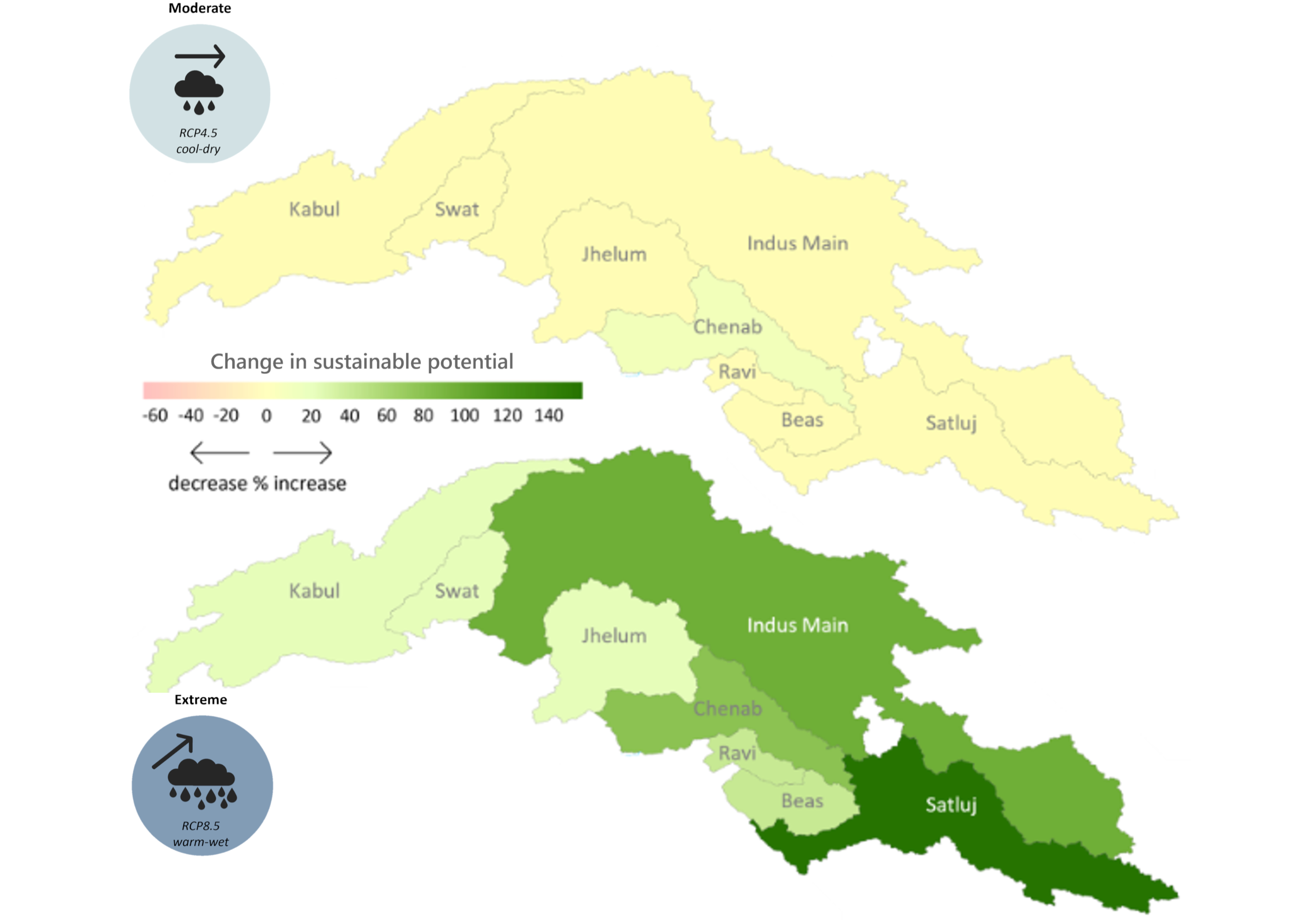
The hydropower potential in the upper Indus basin under future hydro-climatology was prepared using the Hydropower Potential Exploration (HyPE) as part of Work Package 2 in the SustainIndus project. ..
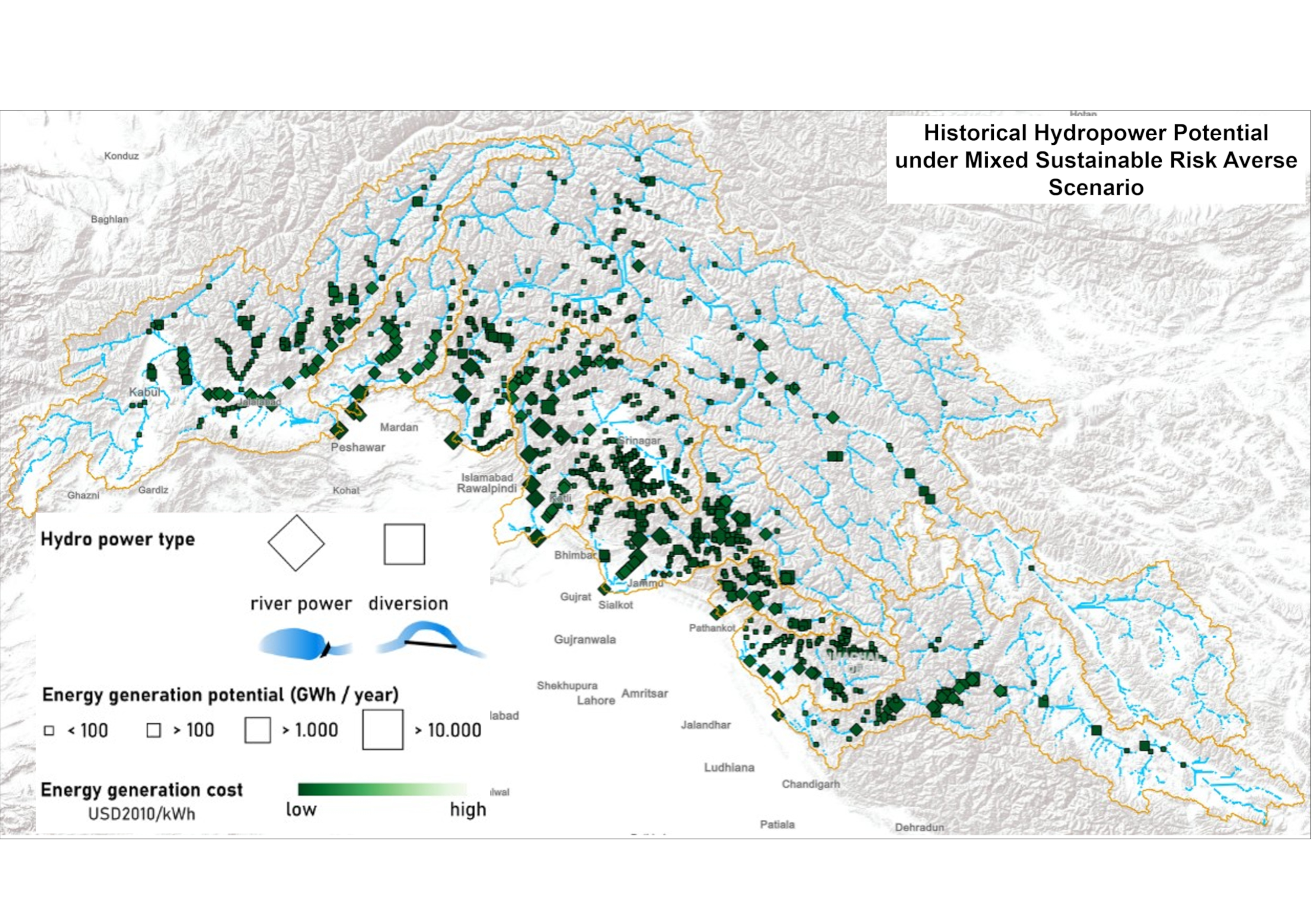
The hydropower potential in the upper Indus basin under historical hydro-climatology was prepared using the Hydropower Potential Exploration (HyPE) model. Under historical hydro-climatology, the HyPE..
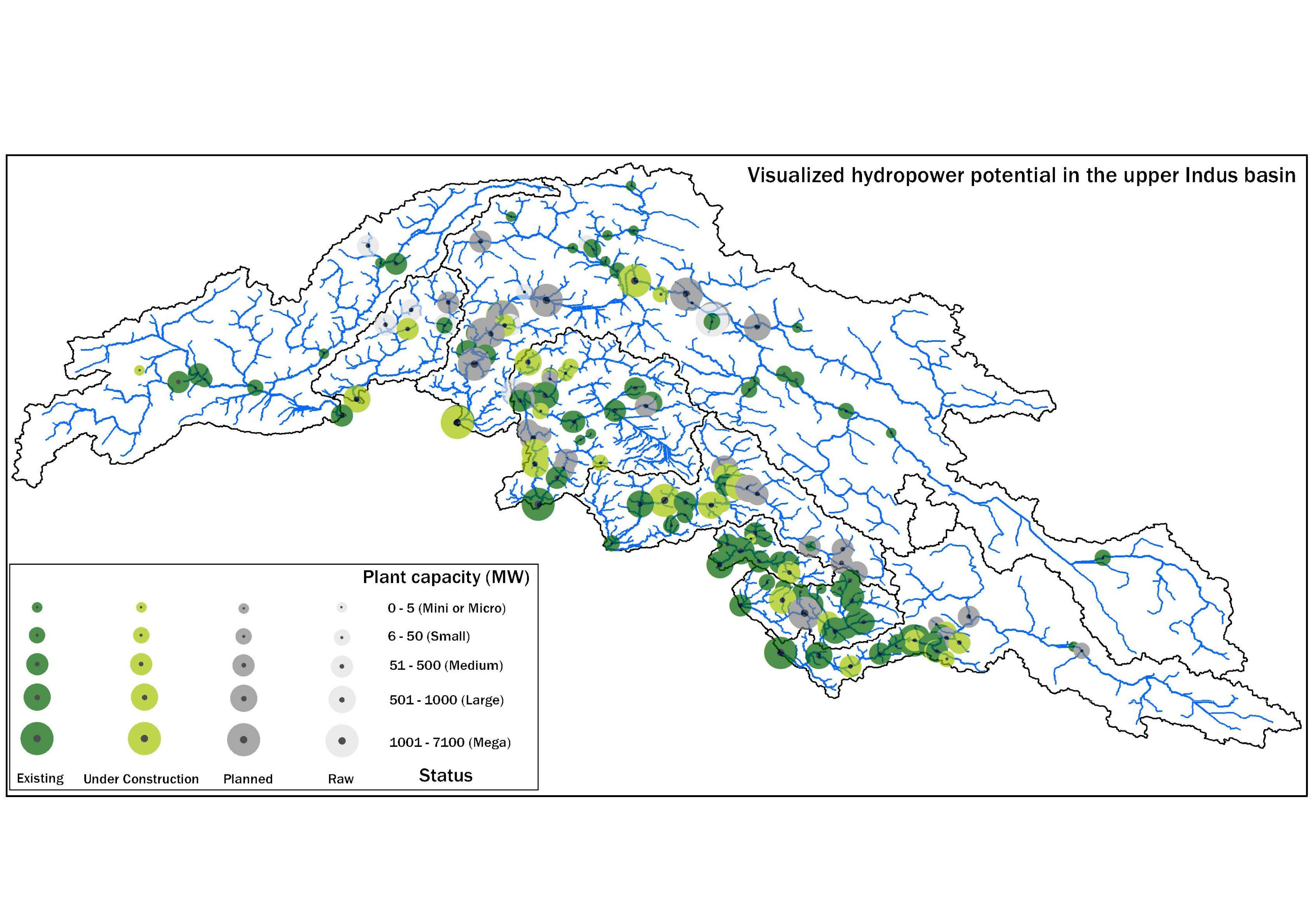
This database was compiled under WP-2 of the SustainIndus project between August 2019 and August 2021 to consolidate publicly available information on hydropower projects in various stages of develop..
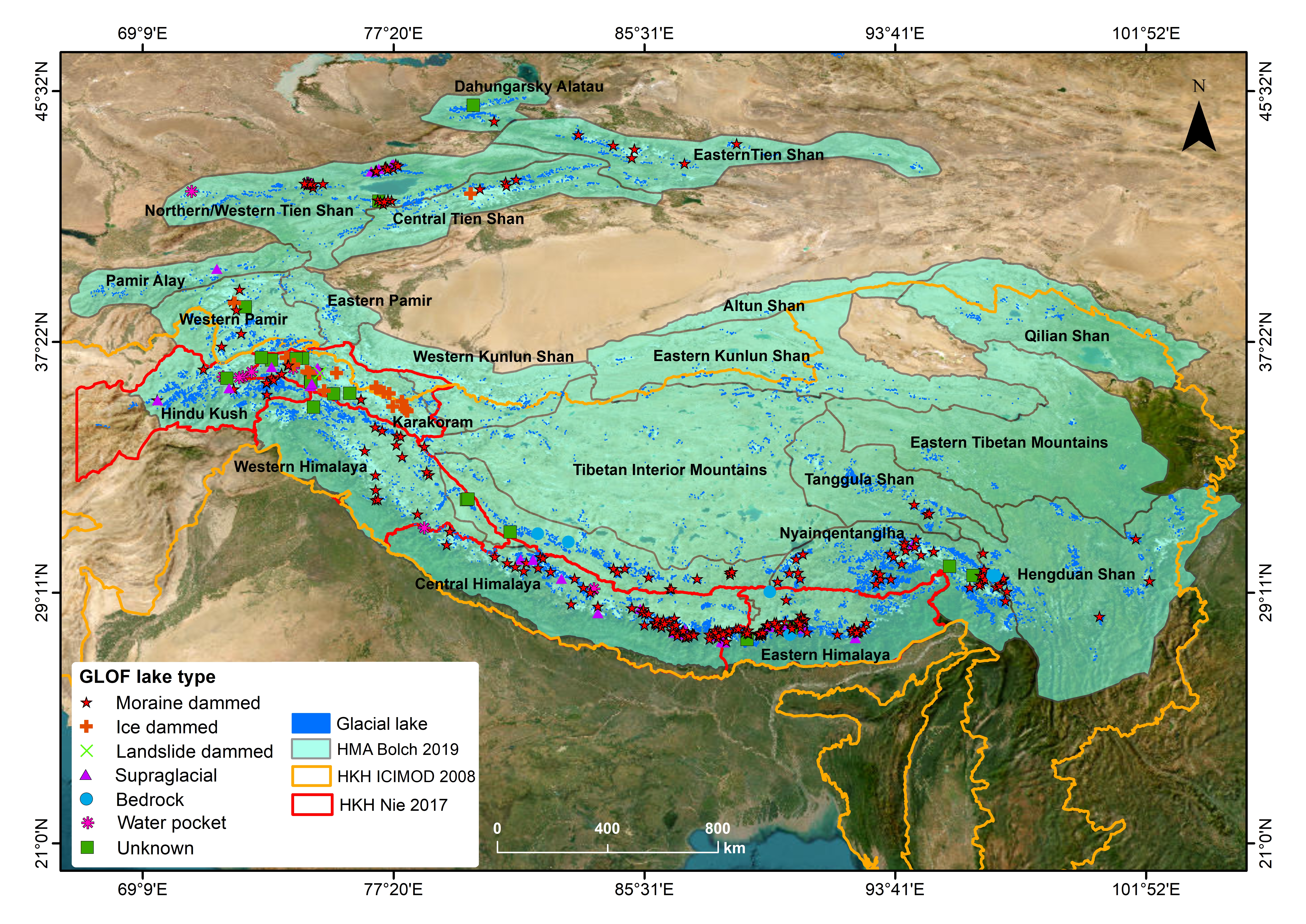
Glacier lake outburst floods (GLOFs) have been intensely investigated in High Mountain Asia (HMA) in recent years and are the most well-known hazard associated with the cryosphere. As glaciers recede..
As part of climate change impact monitoring program on biodiversity, UWICER has initiated HEROES program in 2015. 17 schools covering different altitudinal gradient and geographic region were selecte..
Digital line dataset of Outline boundary of Hindu Kush Himalayan (HKH) Region. This dataset is Basic Vector layer derived from ESRI Map & Data 2001 and is in 1:1 million scale.
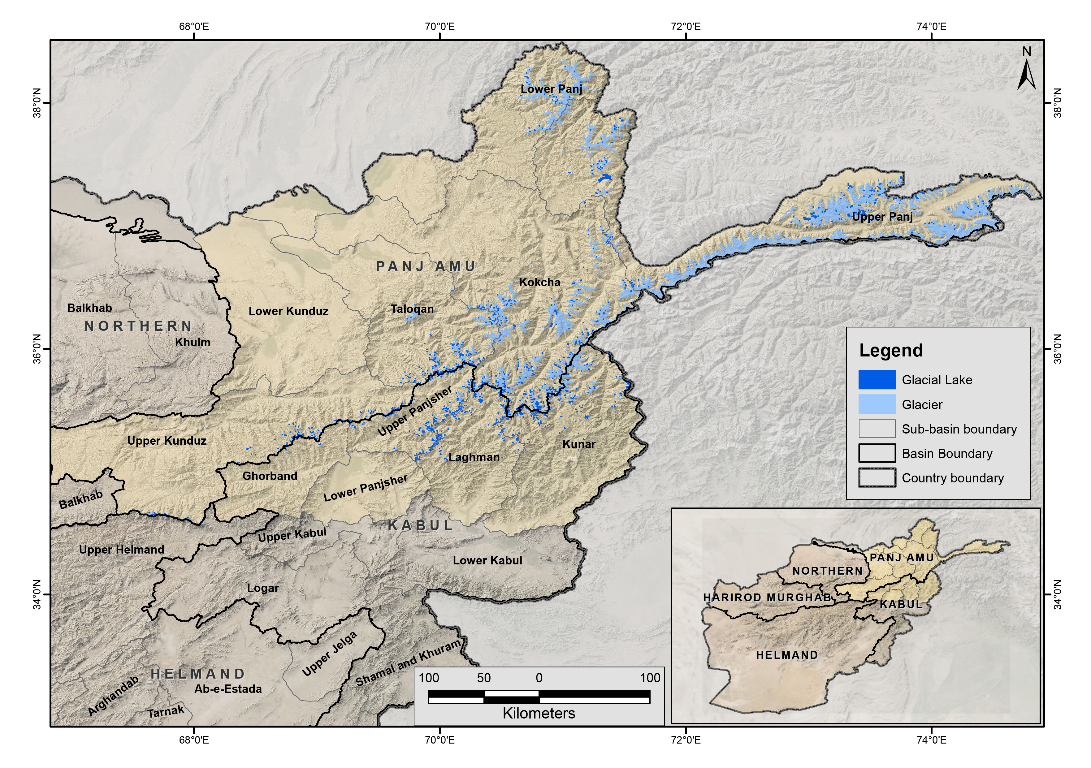
The glacial lakes of Afghanistan were mapped using Landsat image that were selected based in a one-year buffer surrounding a representative year. For instance, the Landsat images from 2014 to 2016 we..
The glacial lakes of Afghanistan were mapped using Landsat image that were selected based in a one-year buffer surrounding a representative year. For instance, the Landsat images from 2009 to 2011 we..
The glacial lakes of Afghanistan were mapped using Landsat image that were selected based in a one-year buffer surrounding a representative year. For instance, the Landsat images from 1999 to 2001 we..