Coupled Model Intercomparison Project Phase 6 (CMIP6) data sets assist the science community in conducting studies on climate change impacts at regional scales, and enhance public understanding of po..
The database contains occurrence records of the endemic plants of Nepal based on the herbarium specimens that have been deposited at the National Herbarium and Plant Laboratories (KATH) of the Depart..
This occurrence database contains records of the mushrooms based on the herbarium specimens deposited at the Natural History Museum (NHM), Tribhuvan University Nepal. Situated on the lap of a world h..
This occurrence database contains records of the mushrooms based on the herbarium specimens deposited at the Tribhuvan University Central Herbarium (TUCH) managed by the Central Department of Botany,..
This occurrence database contains records of the lichens based on the herbarium specimens deposited at the Tribhuvan University Central Herbarium (TUCH) managed by the Central Department of Botany, T..
This occurrence database contains records of the lichens based on the herbarium specimens deposited at the Natural History Museum (NHM), Tribhuvan University Nepal. Situated on the lap of a world her..
The database contains occurrence records of the alien plants of Nepal based on the herbarium specimens that have been deposited at the National Herbarium and Plant Laboratories (KATH) of the Departme..
This dataset lists 21 species of Mistletoes compiled from literature resources as indicated in the dataset. Mistletoes constitute a polyphyletic group of flowering parasitic plants and are commonly k..
Coordinated Regional Climate Downscaling Experiment (CORDEX) data sets for the South Asian region assist the science community in conducting studies on climate change impacts at regional scales, and ..
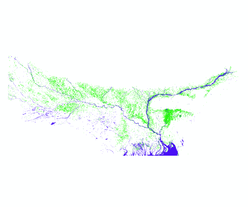
The data proivdes flood extent in July 2020 covering areas of Nepal, India and Bangladesh. The data has been developed as part of rapid flood inundaton mapping activity to support quick and effective..