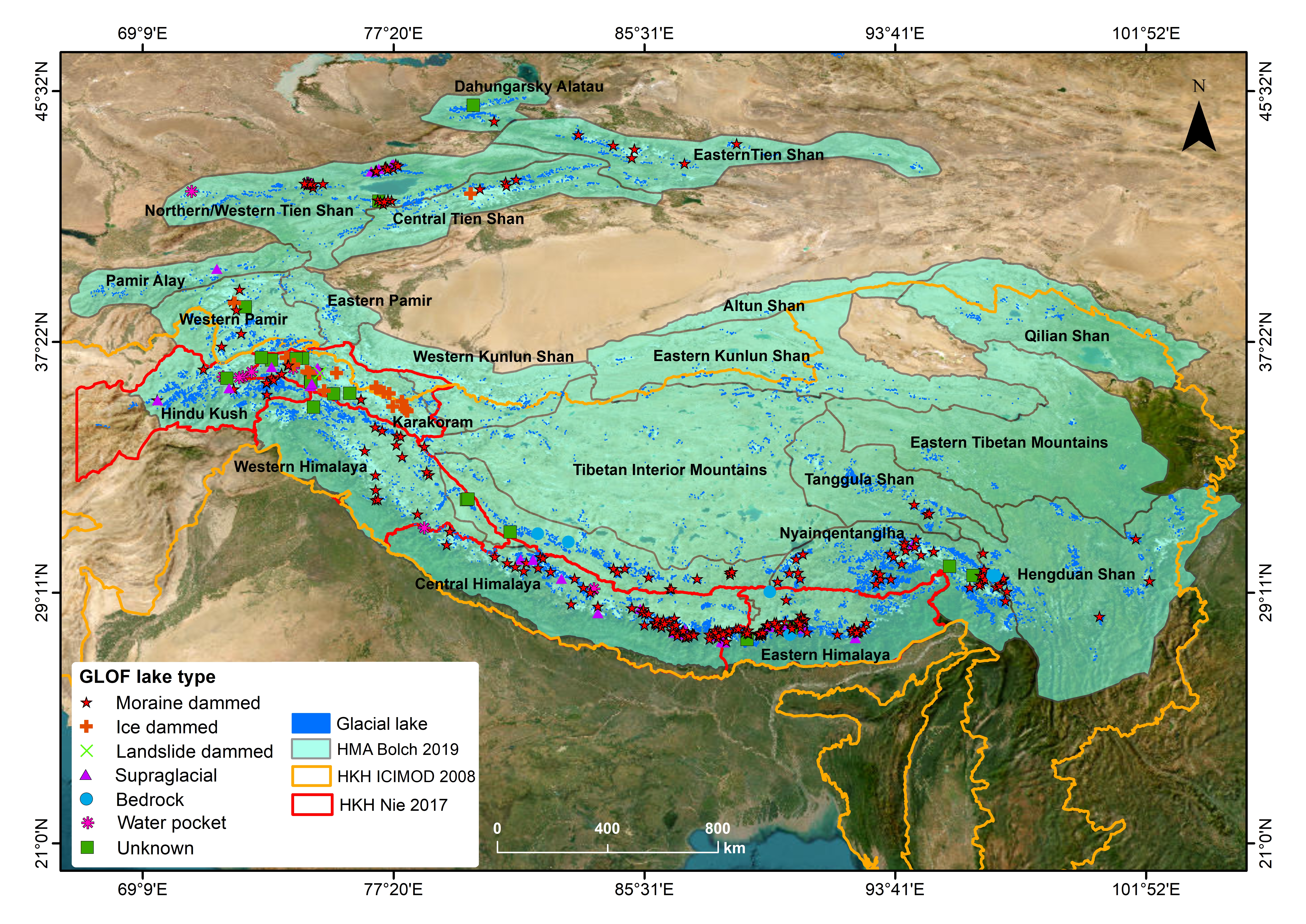
Glacier lake outburst floods (GLOFs) have been intensely investigated in High Mountain Asia (HMA) in recent years and are the most well-known hazard associated with the cryosphere. As glaciers recede..
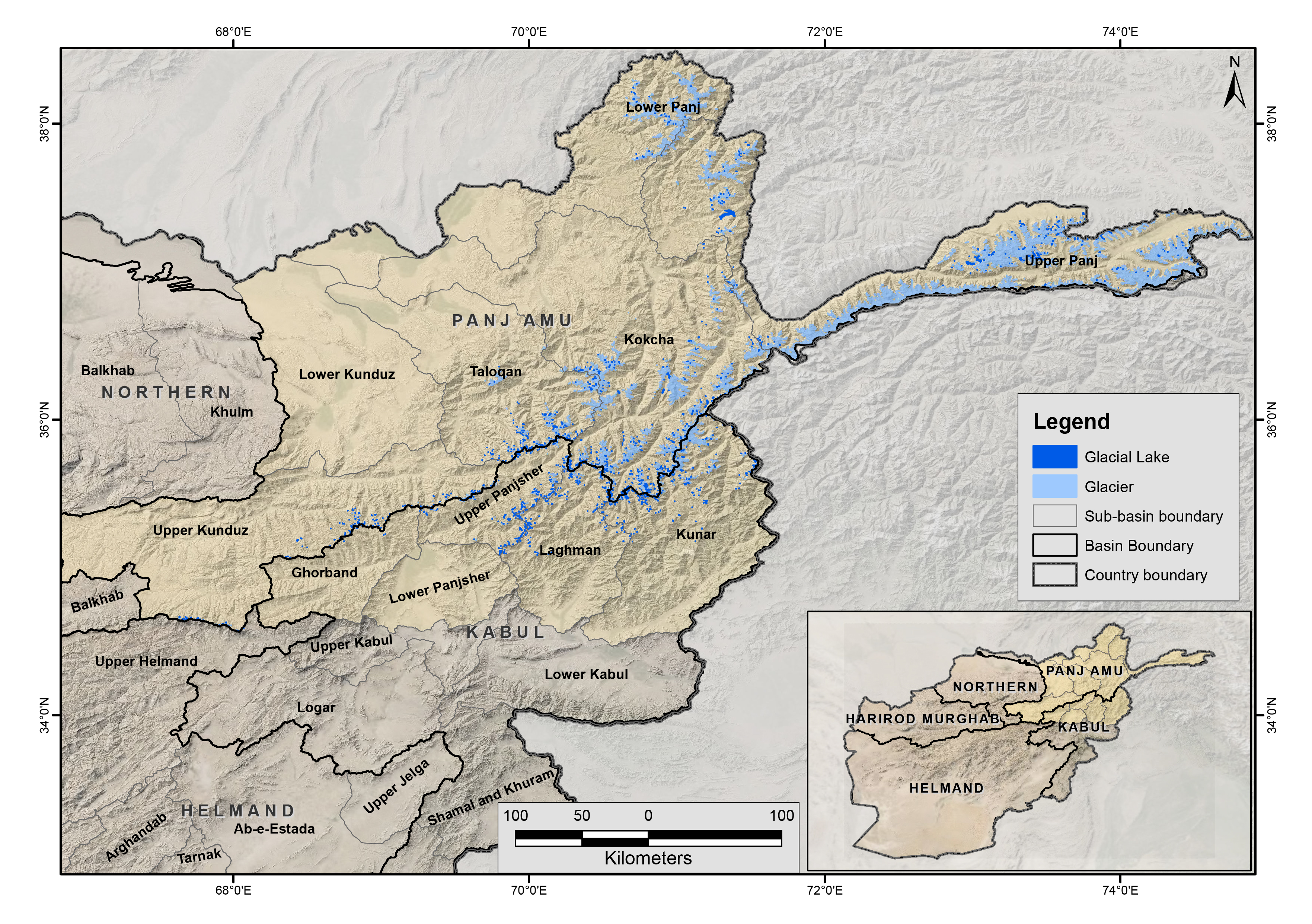
The glacial lakes of Afghanistan were mapped using Landsat image that were selected based in a one-year buffer surrounding a representative year. For instance, the Landsat images from 2014 to 2016 we..
The glacial lakes of Afghanistan were mapped using Landsat image that were selected based in a one-year buffer surrounding a representative year. For instance, the Landsat images from 2009 to 2011 we..
The glacial lakes of Afghanistan were mapped using Landsat image that were selected based in a one-year buffer surrounding a representative year. For instance, the Landsat images from 1999 to 2001 we..
The glacial lakes of Afghanistan were mapped using Landsat image that were selected based in a one-year buffer surrounding a representative year. For instance, the Landsat images from 1989 to 1991 we..
The data contains improved daily MODIS Terra/Aqua combined snow-cover merged with Randolph Glacier Inventory (RGI6.0) product. This product is generated using MODIS Terra and Aqua daily snow cover pr..
The data contains an enhanced MODIS 8-day Terra (MOD10A2) and Aqua (MYD10A2) collection 6 snow-cover composite product merged with Randolph Glacier Inventory (RGI6.0). The data is specifically devel..
Of the 3,800 glaciers in Nepal, we have been systematically monitoring Yala Glacier in Langtang, and Rikha Samba Glacier in Mustang since 2011. Data collected from these glaciers are submitted to the..
Glaciers are one of the essential climate variables (ECV) to better understand the climate system. The regular monitoring of the glacier mass balance gives information about the water stored and rele..
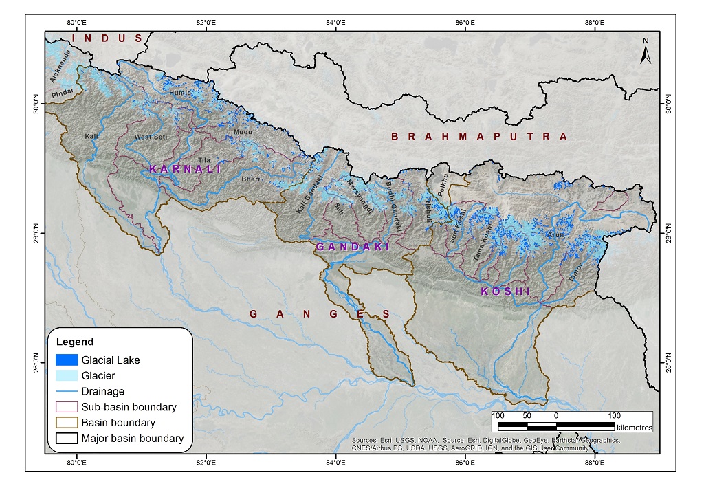
The data on glacial lakes in 2015 were derived through a semi-automatic method using Landsat imagery from 2015 to 2016. The Normalized Difference Water Index threshold value was used for classificati..