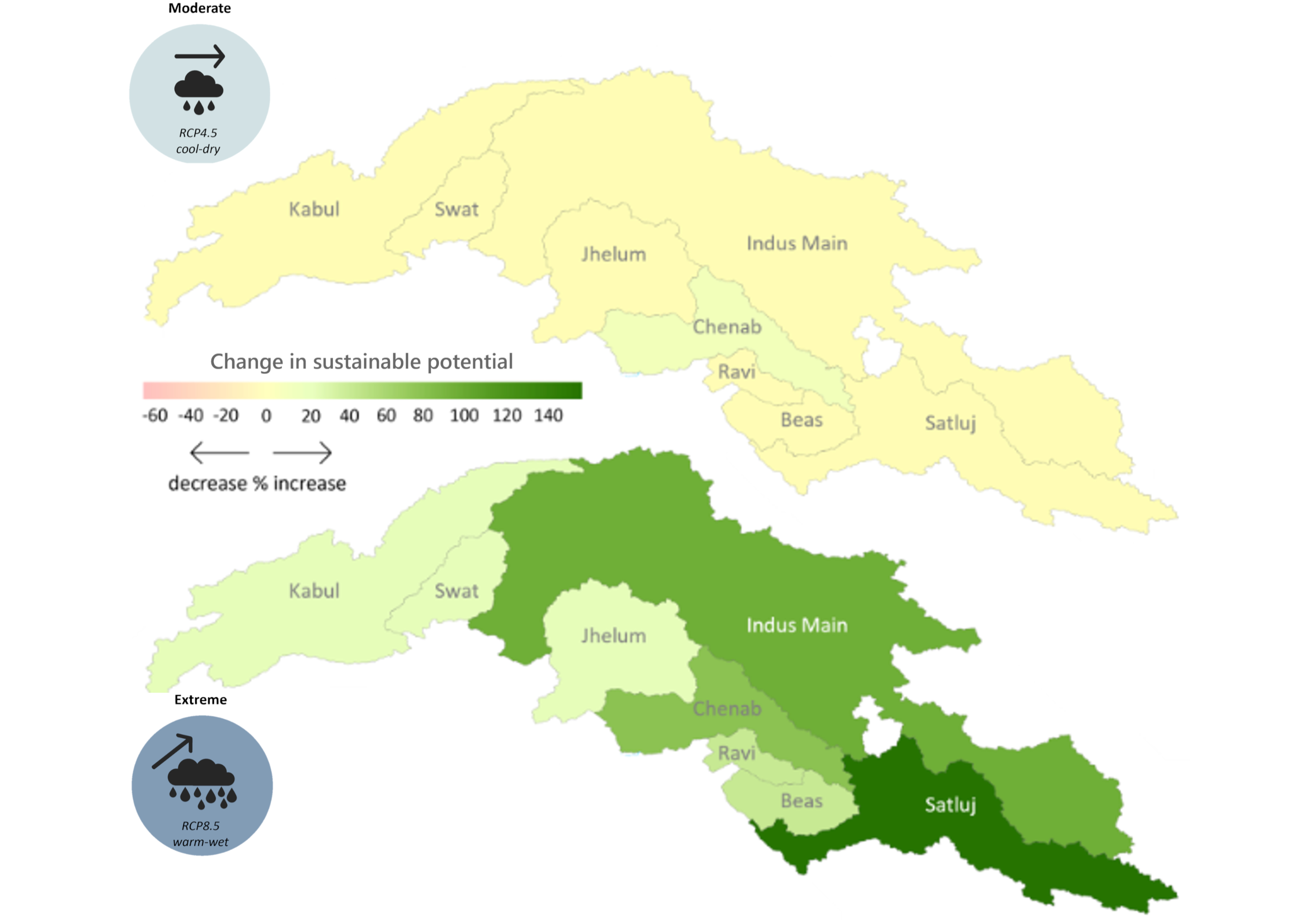
The hydropower potential in the upper Indus basin under future hydro-climatology was prepared using the Hydropower Potential Exploration (HyPE) as part of Work Package 2 in the SustainIndus project. ..
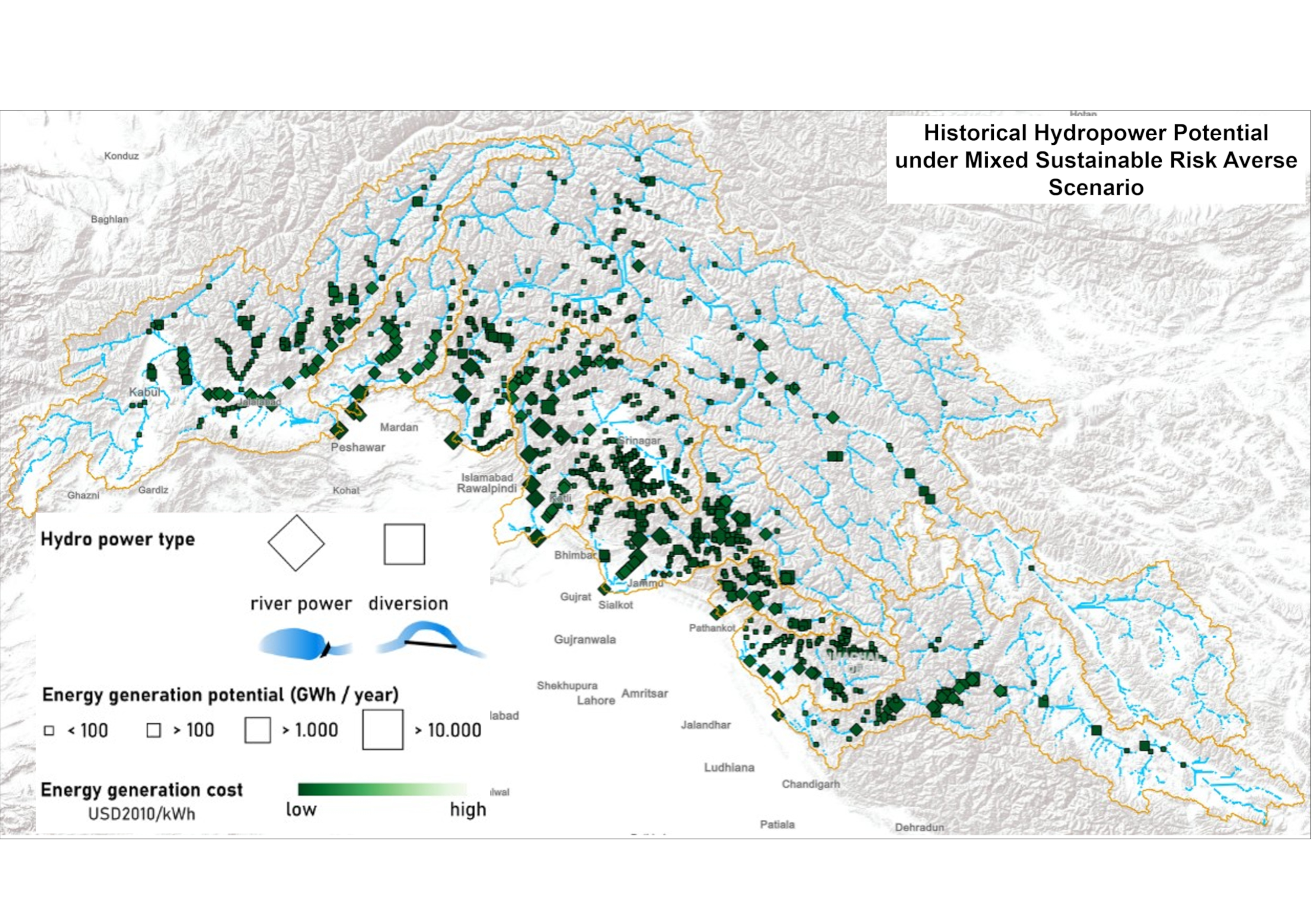
The hydropower potential in the upper Indus basin under historical hydro-climatology was prepared using the Hydropower Potential Exploration (HyPE) model. Under historical hydro-climatology, the HyPE..
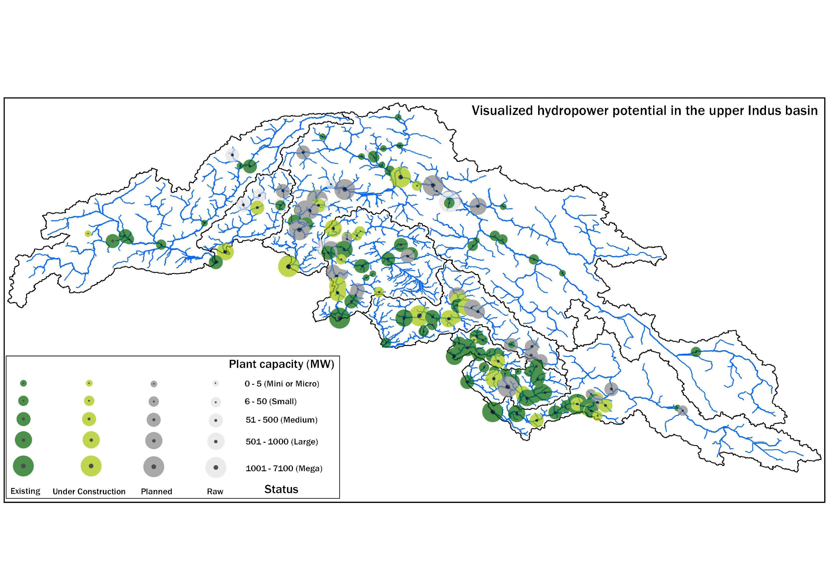
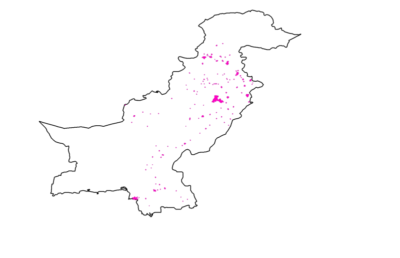
This database was compiled under WP-2 of the SustainIndus project between August 2019 and August 2021 to consolidate publicly available information on hydropower projects in various stages of develop..
Land cover change is a significant contributor to environmental change. The degradation of forests and conversion of natural areas, forests, and farmlands to other land use impact ecosystem services ..
The assessment of meltwater sourcing from the clean and debris-covered glaciers is scarce in High Mountain Asia (HMA). The melting rate varies with the debris cover thickness and glacier orientation...
The assessment of meltwater sourcing from the clean and debris-covered glaciers is scarce in High Mountain Asia (HMA). The melting rate varies with the debris cover thickness and glacier orientation...
Digital polygon dataset of Glacier exposed rocks of Central Karakoram National Park (CKNP) area, Pakistan. This dataset is created using topographic sheet maps at scale of 20000.
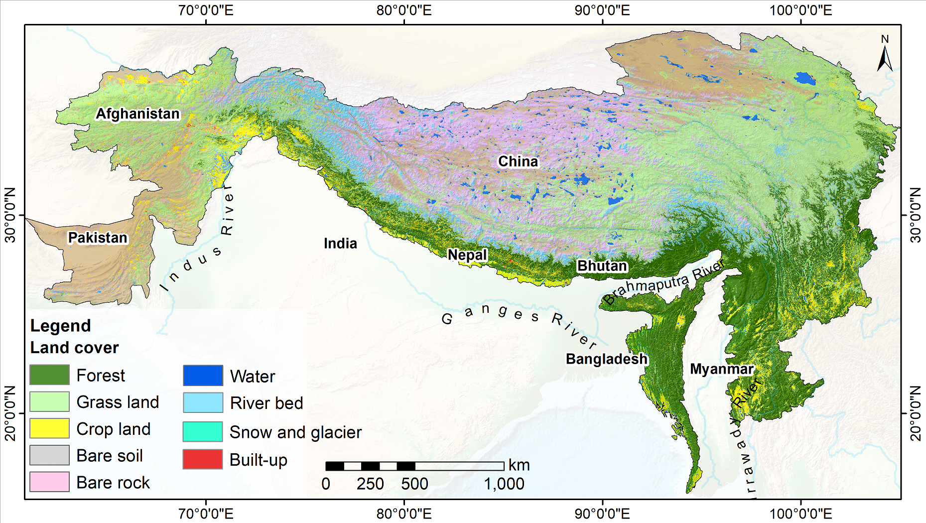
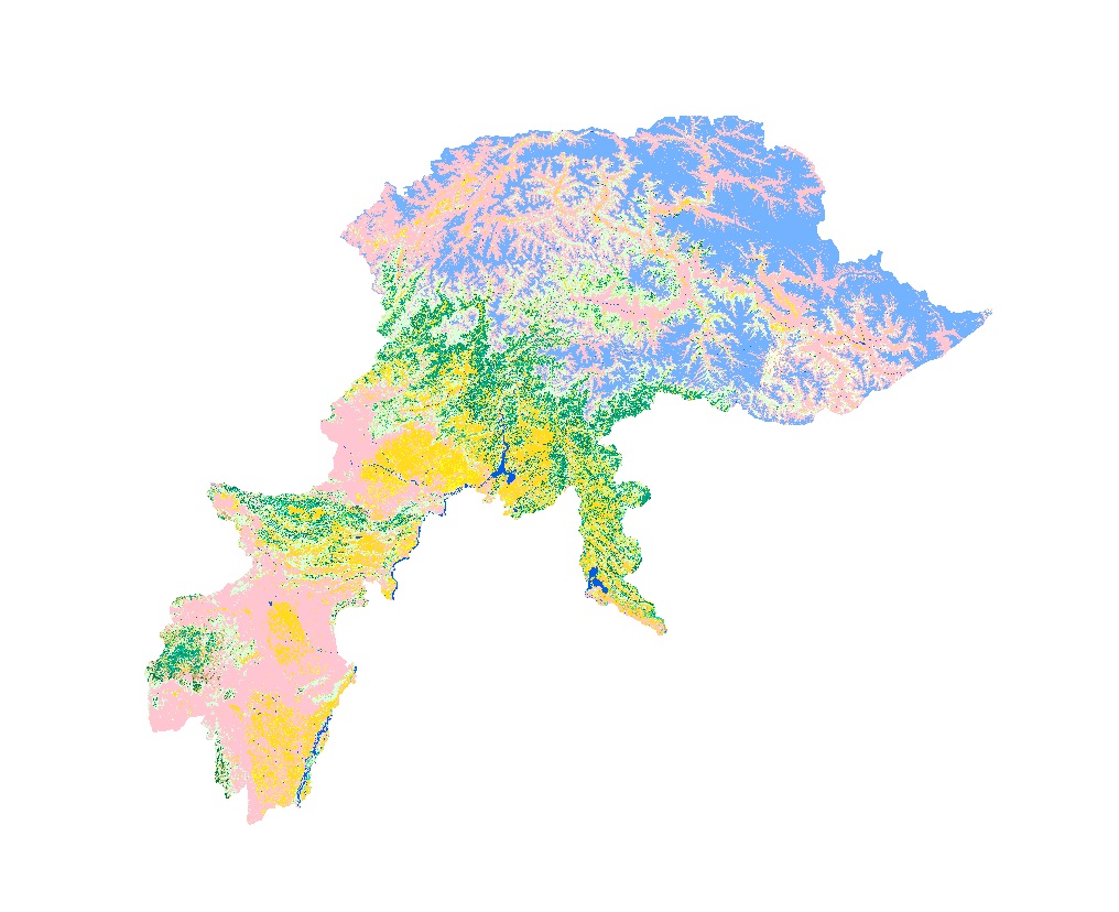
Land cover data of Hindu Kush Himalayan region of Pakistan for 1990. This dataset is created using the LandSat 30 meter spatial resolution satellite image of 1990.
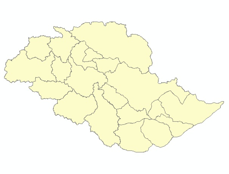
Digital polygon dataset of Tehsil boundaries of Central Karakoram National Park (CKNP) area, Pakistan. This dataset is created using topographic sheet maps at scale of 20000.